Fact File:
Time: 3 hours
Map: OS Explorer 287 West Pennine Moors

Map by kind permission of Johnston Press
locate a stile in the corner. Cross this onto Whalley Golf course and turn left following the edge of the course.

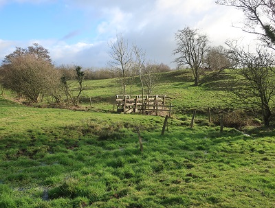
After 200yds cross a small footbridge on the left and then passing through an area of young trees cross a stile leading onto pastureland. Before you the scene opens out with a long view up to the top of Clerk Hill.
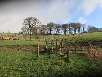
This is where you are heading. As you near the top a fence to the left funnels you to a corner where you climb two stiles in quick succession keeping right. With a property on the right edge round it to arrive on its tree covered drive.

Turn left and soon after reach Clerk Hill Road a quiet country lane. Turn left. Walk along the lane for 600yds then turn left onto a public footpath
leading into an area of gorse covered heathland. At first onto a quarry track follow the wall to the left until you reach the top of the ridge

where you will be rewarded with wide views of the Ribble Valley. The rest of the walk takes you down into the Ribble Valley. A short distance into your descent go through a gate on the left (on the corner of a wood) and then at an angle traverse the field bearing right. On this course go through a gateway to the adjoining field and continue to a stile

in the corner. From here the path descends more steeply to the drive next to Sheep Cote Farm. Turn right on the drive which soon becomes a lane leading into the hamlet of Wiswell which as you will see is much decorated in the "Best kept" competition. Pass the Freemason's

and then turn left onto Old Back Lane. Turn right onto the next drive then cross a stile onto an enclosed path. After the next stile cross a field to a gate way. Through this go right to a stile and after crossing this turn left on a path leading to the busy A59.

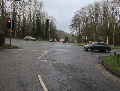
Cross with care using the central reservation as a staging post. On the far side climb the embankment then go left. After a kissing gate cross a field to cross a small brook on its boundary
keeping to the right as the path links up with a track

leading onto Clitheroe Road. Cross the road and turn left. Walk along the road for 180yds and turn right onto a footpath just before the Eagle pub.

The path doglegs behind a building to emerge into pastures. With hedgerow to the right cross a field to a level crossing.

Over the railway keep the fence to the right across two fields

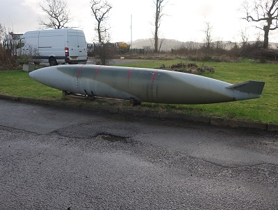
and then bear right to a field corner close to Brook House Farm. Over a stile join a drive down to Mitton Road. Turn left. Keep in the road for ¼ mile then turn onto a drive of a commercial unit adorn by what appear to be torpedoes.
Just before the building go right to enter a large pasture with the A59 in the distance. The way follows the edge of a depression leading to a footbridge
over a brook and then continues to the A59. Cross with care. The designated footpath is below the embankment and goes right for 180yds to enter playing fields but as readers will see it is somewhat overgrown. The suggestion here is to turn right on the verge until opposite the stile leading onto playing fields. Once clear of the fence cross to a cinder track
and follow it to Mitton Road. Turn left. Before the railway bridge

turn right onto a drive alongside the impressive viaduct. After 300yds at a junction turn left to pass under the viaduct and then a medieval gatehouse (a tangible arrangement of "ancient and modern").

Follow the lane pass the RC church, Whalley Abbey and the parish church to arrive in Whalley centre. Turn right and having crossed the road walk down to the last street on the left before the bridge. Turn into Calder Vale to be quickly rewarded with a view of the River Calder close to its hydro scheme.

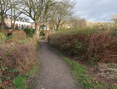
The footpath leads along side the river
and then goes left to arrive on Accrington Road. A footpath opposite cuts a corner to the start.