As mental health has moved up the agenda attention has been given to various approaches to help people deal with illness. Before coronavirus came along television news reported on the efforts made by schools, sports organisations, community groups to open up the subject. All this to the good. Yet in a sense the emphasis was on grappling with the symptoms without addressing the causes. Before the lock-down modern life had become excessively stressful. Firstly it was characterised by incessant noise – traffic, technology and television – impacting on our ears. Secondly the nature of work had changed completely in the previous 30 – 40 years. Those “lucky” enough to be in jobs were less secure and target driven to produce data generated results. Machines were becoming like humans and humans like machines. Finally some of the self-administered remedies used to mitigate the stress such as alcohol or worse were generally harmful and short lived in their effects.
Now we find ourselves in the midst of a Global emergency caused by the Covid 19 pandemic. In his address to the British people on Monday 23rd March the Prime Minister instructed us to stay at home and not to leave it unless we were a key worker, or for essential shopping and medical reasons or for exercise. The reason for this draconian measure was to help slow down the spread of the virus and thereby not overwhelm the NHS. Following the practice used in other countries – notably China, Spain, Italy and Germany the nation found itself in lock-down. While the policy was understood and almost universally supported it is not without a massive cost to the economy and to individual lives.
The walk below is one I can do from my house in the soon to be published “100 Walks in Penwortham”!
Distance: 4 miles
Grade: Easy

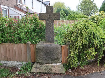
Directions: As a memorial I always like the sentiment on the ancient base of the restored Howick Cross "to Commemorate Peace 1919".
From it cross Howick Cross Lane and walk along Liverpool Road soon to meet its junction with Penwortham By-Pass.

Keep ahead to the right of the cycle path until you reach Ratten Lane.

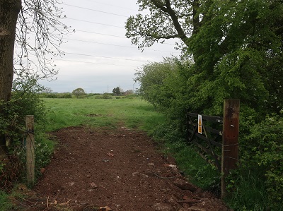
Turn right. After passing through an area of residential properties the lane reaches open countryside with wide views especially to the north.

After passing Sherdley Farm on the left turn right onto a narrow footpath between properties

leading to a stile. Over this dogleg right

to follow a clear path across two fields
before it dips into an attractive valley formed by Mill Brook. Cross a stile somewhat enclosed by bushes

and bear left. The idea now is to follow Mill Brook

all the way to its meeting with the River Ribble. The stream leads onto the flood plain as the path enters a ribbon of woodland.

When it meets a track keep ahead on the tree lined path.

In 500yds you reach the River Ribble.

Turn right to cross Mill Brook over a wide culvert. Ahead bestriding the river 4 pairs of pylons carry power lines

over the water in a display of impressive but generally unappreciated engineering. After the first pair a right turn onto a public footpath will return you to the end of Howick Cross Lane. After the second pair enter an area of overgrown brushland through a kissing gate

keeping left and then after 150yds turn right

onto a footpath leading to a flight of steps.
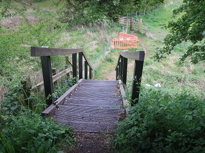
Down these keep on the path leading to the right of a pumping station

which as unimpressive as it looks forms a vital part of Preston's flood defences. After skirting the perimeter of the facility the path crosses a large field to a metal gate

close to a twin set of pylons. From here a track leads up to Howick Hall Farm.

As you reach the farm keep left to join the drive which will bring you back to Howick Cross Lane. Turn left for the start.
