Inglebrough
Ingleborough is Britain’s Table Top Mountain. Although some 1100ft lower than its South African equivalent its summit is big and flat giving it from most angles the appearance of a table top. Partly because it is so easily identifiable and partly because it is one of the Three Peaks of Yorkshire along with Whernside and Pen –y-ghent a famous challenge walk and fell race it is one of Britain’s most popular hills. It allows walkers to point it out from a great distance away and nonchalantly inform admiring companions, “Oh look its Ingleborough – I’ve climbed that!” When I first climbed it back in the mid-70s it was almost my last walk of any kind. Ostensibly I was leading young people from St Joseph’s Ribbleton Youth Club. I had been roped in because I was qualified enough to drive a mini-bus. Ignorant then of what I was letting myself in for I allowed my co-worker to organise an ascent of Ingleborough from Ingleton. Up to that point I thought I was fit. As the walk progressed I realised I wasn’t. I was a smoker. Most of the dozen or so youths in the party were smokers too but that didn’t stop them bounding up the fell side like mountain goats. It has to be said I had to be coaxed painfully up. Even though weather conditions were excellent, the trail was good underfoot and the objective was attained at that point and for a few years afterwards Ingleborough was my nemesis as far as hill walking was concerned. Reformation was gradual and when I eventually gave up smoking New Year’s Day 1982 I became hill fit. Later that year I walked the Three Peaks and have done it several times since. The curse was lifted.
The walk described below was one we did with the Norwest Fellwalking Club last month. In my party Joe had climbed Ingleborough before but it was new to Barbara and Jill. The day was clear but was marked by very strong winds on top. In fact descent from the trig point was something of an ordeal as we were walking directly into the wind. After that struggle and we were able to walk upright again it was good to look back at the summit and think, “Oh look its Ingleborough – we’ve climbed that!”
Start: Clapham Yorkshire Dales National Park Information Centre and car park LA2
End: Ingleton Village Centre

Note: There is a regular Monday - Saturday bus service between Ingleton and Clapham (No 581 between Kirkby Lonsdale and Settle) if you need to return to the car in Clapham. If you decide to walk using the (quiet) Old Road add four miles (approx. 90mins) to the distance below. If wishing to stay off road there are footpaths connecting the two villages but you'll need to check these out for yourself!
Fact file:
Distance: 8 miles
Time: 4 - 5 hours unless a fell runner.
Grade: Strenuous.
Map: OS OL2 The Yorkshire Dales Western & southern areas.
Map by kind permission of Johnston Press
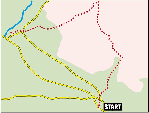
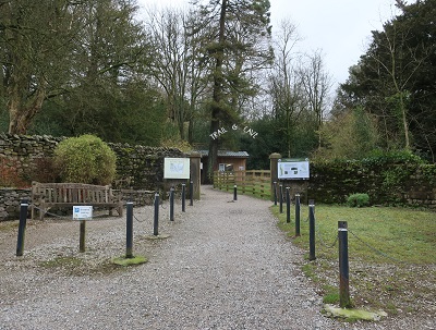
Directions: The great thing about approaching Ingleborough from Clapham there are a number of intermediate objectives breaking the walk down into psychologically manageable chunks - Clapdale - Ingleborough Cave - Trow Gill - Gaping Gill - Little Ingleborough - Ingleborough. And each stage provides a great deal of interest. But first there is a decision to be made soon after starting the walk. Turn right out of the car park and walk up to St James Church (1st item of interest).

Go left in front of the church and cross Clapham Beck then bear right with 2nd item of interest coming into sight with an impressive cascade issuing from Clapdale to the right.

Ahead you can follow the nature trail (3rd item of interest) through the Ingleborough Estate for the fee of £1.
Readers wishing to avoid the fee can continue along the lane for 50yds then turn right onto the bridleway which leads to Clapdale Farm then down to Clapdale itself. Pay the fee - it's more straightforward and rewards you with countless points of interest explained in detail on numerous information boards. The trail leads up to an attractive artificial lake

and continues through the wooded valley. After a grotto

much loved by children the trail exits the woods

then soon after reaches the entrance of Ingleborough Cave. (4th item of interest - not counting the countless ones on the nature trail).

If you are in any doubt a banner outside this attraction will tell you it is one of the country's finest show caves - one that is sure to reward you every effort you have made in reaching it as well as the £9 admission fee something I can personally attest to. Moving on the trail continues along a steep sided valley for 600yds before turning into a limestone canyon that is Trow Gill (5th item of interest). The further in you venture the more the cliffs crowd in

until you pass through a narrow cleft that climbs to another scene altogether - pastureland. The path hugs a wall to the left for over half a mile. After climbing over it at a stile

the main objective comes into sight. The track is obvious but soon after the wall take time to view the outside of one of the country's deepest holes - Gaping Gill to the right of the main track. (6th item of interest).
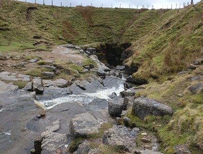
Fell Beck by virtue of flowing into it creates England's longest unbroken waterfalls - a drop of 322ft. Twice a year caving clubs hold meets where members of the public are winched down to the chamber floor to view the cavern from the inside.
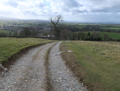
The rest of the walk is quickly described. Return to the main path
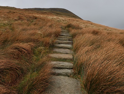
obvious as it ascends Little Ingleborough

then following the track as it heads north keep on it for ¾ mile top the point it reaches the broad summit. The summit shelter and trig point

are on the far side on this approach. The path for Ingleton is slightly to the south-west from the trig point marked by a cairn. It is very steep at first
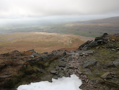
but eases up with a broad track

leading down to the farm Crina Bottom
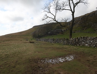
and then to the edge of the village.