
Fact File:
Time: 4 ½ - 6 hours
Map: OS Explorer 287 West Pennine Moors

Directions:

This takes you through woodland to the River Ribble. After exiting the woods
keep ahead to Dinckley Suspension footbridge.

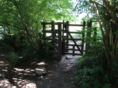
Pass the bridge to follow a path into a wooded area. At a gate turn left over a stile and continue on a fenced path bringing you to Ellis House

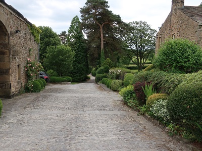
with its impressive garden wall. When you reach the drive follow it up a rise and after 200yds turn left over a stile to enter a field. Keep left within a fenced off section

until you come to a stile on the far side. Over this turn right and at the top of the slope go through a gateway

and turn right. When you reach the farmhouse (Cravens) turn left cross to a metal gate and then onto a drive close to a sprawling farmstead.
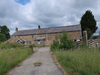
Turn left onto the drive and almost immediately right onto a footpath which dog legs past a ruined farm building

and descends to a footbridge. On the far side go straight taking a path that leads to a residential area part of the Brockhall Village. Bear slightly left passing the entrance to Blackburn Rovers FC training facility.

Following the track with tall hedgerow on each side to a stile. Over this at first keep ahead and then bear left to skirt the farm buildings of the dilapidated Brockhall Farm.

When you reach the drive turn left and follow it downhill to the floodplain of the Ribble. As you reach it keep right alongside the trees until you come to the river.


As you come close to the confluence with the River Calder bear right and locate a stile in the fence to the left of the Hall. Cross another diagonally left and then go straight aiming for the drive leading down to the Hall. Once on the drive keep on it until you almost reach Old Langho Road. Here next to a detailed sign

about the dangers of dog poo cross the first of three stiles that dog-leg (no pun intended) the route through paddocks. After the third stile turn left and then after a gateway bear right to reach a dense hedgerow. Here you have to locate an awkward stile almost hidden by vegetation.

(About 75yds from the right boundary of the field.) Through this climb the rise skirting Hacking Wood to the right. After a stile next to a metal gate go left on a path leading towards Brockhall Village. As you reach a track

stay on it until you arrive on Old Langho Road. Turn right. Pass the entrance to Brockhall Village

and soon after come to St Leonards Church on the right.

After a stile next to a metal gate keep ahead edging round the complex and then descending to a footbridge over Dinckley Brook.
On the far side climb the slope and then follow the path as it edges a field turning left and soon after comes to Aspinalls. Keep straight

until you come to the drive on the far side of a barn. Here cross a stile on the left. On a waymarked path

keep straight crossing a succession of fields to drop to the rear of Wardfall.
On the lane go right to a stile opposite. Cross to a metal gate and in the next meadow as you near the brook to the left turn right to head up the slope for almost ¼ mile to join the drive
for Dinckley Grange. By the house and cross a stile at the end of the lawn on the right. Turn left. The route now crosses two huge fields heading roughly west keeping to a boundary to right.

In the second field after a stile set in stone

cross a footbridge

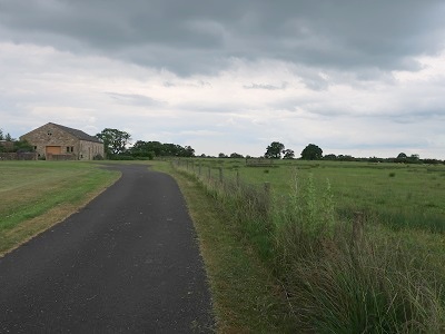
and then climb the slope to a stile by a metal gate. By a smallholding follow the drive

to the A59. Turn right to enter Copster Green

and follow a track past cottages and continue after a left turn to a farm. Keep ahead between buildings to join a grassy track.

When this reaches a junction of footpaths cross a stile and turn right. Keep to the field boundary and after crossing into the adjoining field

bear left to commence a long descent to the car park.

The route enters a rhododendron plantation and exits close to Ribchester Road. Turn right for the car park.