Fact File:
Time: 4 - 5 hours + 40 minutes for optional diversion
Map: OS OL41 The Forest of Bowland.

Directions:

and climbs away from it steeply. After a sharp bend turn right onto a footpath

accessed by a wooden gate. Follow the path through a field as it brings you alongside a wall gaining elevation to arrive at a step stile close to a metal gate.
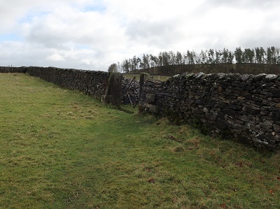
Cross this and with a wall to your left continue for 300yds to a metal gate on the left. Through this continue in the same direction with the wall now to your right gently descending to a quiet lane.

Cross this directly onto the drive of Broadhead Farm an impressively large complex. Passing the main farm to your right keep ahead and then bear right into the yard at the rear.

A farm track crosses a brook and out into fields. Follow this and the waymark sign on a post indicating straight ahead. After a second metal gate the track peters out so aim diagonally right to what is in effect the far corner about 300yds distant. Here turn right through a metal gate,

ford a narrow stream and then after crossing stepping stones at the next stream

turn left through a wooden gate

on a path taking you up to Skelshaw.

When you reach the farm house continue on a broad farm track leading resolutely uphill to the next farm - Fellside a little over ½ mile away.

While the climb is sustained it is rarely steep. As you arrive at Fellside and its dogs turn left through its yard and go through a gate

onto the open fell. The climb continues now amid moorland splendour.

Keep on a rough track

until it levels out bringing you to the Waddington Road B6478.


and follow it around the edge of the quarry

heading towards a radio mast.

The trig point is close to this in effect on the far side of the quarry. After enjoying one of the finest views in the county, country, universe …retrace your route to where you joined the road. Keep on the road for almost a mile.

After a large bend and at the corner of the next turn left onto a private road

leading

to New laithe Farm. After going through its yard keep ahead on a track

to where it bends sharply left.

Here cross a field corner over a duet of wooden stiles and then continue downhill with the fence on your right. After a wooden gate

follow a tree-lined green lane to a farm outbuilding.

Here join a drive ahead leading to a lane.

on the left leading onto the riverside meadows of the Hodder. The last part of the walk follows this beautiful river back to Slaidburn. Bear right in the first field crossing to a wooden gate. After this bear left to a step arrangement in a fence with the river in full view before you.

The path soon brings you alongside the water

and then continues to the B6478 just before Newton Bridge.
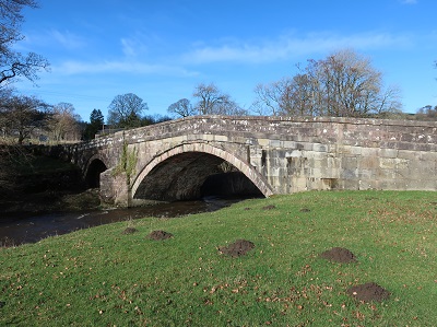
Turn left to cross the river and then on the far side turn immediately right to follow a obvious path

back to Slaidburn.

After Dunnow Hall on the left
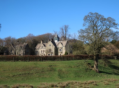
the path briefly leaves the river as it circumvents the sewage - as one would do.

Back on the banks the path takes you through a patch of woodland before emerging on the green close to the village hall with the car park directly ahead.