

Turn left on a footpath that crosses the car park to a footbridge crossing the railway.

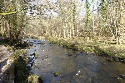
Continue on a footpath that follows the River Brock

under the M6 motorway. 300yds beyond the motorway cross a footbridge on the right and continue on a path leading up to a lane by New Bridge.

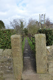
Keep ahead crossing to a stone squeeze stile
and follow the path that edges alongside a property at the far side of which cross a stile

into a large field. Still with the river to the left though obscured by trees keep ahead until you arrive at Walmsley Bridge.


onto a footpath taking you back alongside the river. After ½ mile the path enters a large long field and bears left to meet a track on the edge of woodland.

Turn right on the track and follow it through woods. After passing a signpost for Brock Bottoms Mill pointing right the river bends northwards
while the path enters a less wooded space after a coin studded log.

leading up through trees.

This steep slope is marked as Nanny's Breast on the OS 25,000 map. As the path levels off cross a stile


to enter a field. Keep ahead for a short distance and then bear right noting a fine view of Beacon Fell to the right.

On the far side cross a stile by a metal Gate

leading onto Brock Mill Lane. Turn left. Keep on the lane past the next junction to the left

where it becomes Gonder Lane. Pass the junction with Bleasdale Lane on the right.

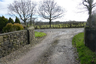
¼ mile further on turn left onto the farm drive of what you will soon discover is the well named High House Farm.

As the track bends to the left take a footpath on the right through a metal gate.

Cross the field to a stile by a metal gate on the far side.

Once over the stile turn left alongside the hedge. By now you will be experiencing a remarkable sense of elevation all the more surprising because apart from the short ascent of Nanny's Breast you have not done any noticeable climbing. Continuing in a southerly direction confirmed by the dreaming spires of Preston in the distance cross another stile

and begin a gentle descent to a wooden gate in the field corner. Through the gate

a very muddy track leads to Clarkson's farm. (This may be best avoided by entering the adjoining field through a convenient gap and walking parallel to the track). Cross over a stile into the driveway of Clarkson's Farm.
Turn right onto a lane and then soon after left

onto Walmsley Bridge Lane. When you arrive at the bridge

cross it and turn right onto a footpath to retrace your outward steps.
