Fact File:
Time: 3 - 4 hours
Map: OS OL21 The South Pennines.

Directions:

The route keeps to the left of the main building,

passes through the formal gardens joins Lime Walk and then continues to Foldy's Cross.

Here keep ahead to arrive on the Barwise entrance car park.

Go through it to reach Todmodern Road (A6114)Turn right but soon after cross the road

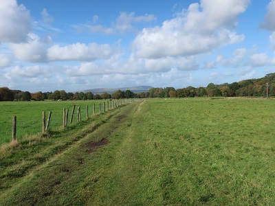
to a footpath signed as being on the Burnley Way. This climbs at first through woods and then on an enclosed path

alongside open fields with a fine view towards Pendle Hill. Keep on it as it runs alongside the busy A646 heard but not seen just yet on the left. At a gate

turn right and soon after cross to a drive.

Almost immediately after joining it take a footpath on the right that climbs steeply up an embankment and then continues fence enclosed

to climb first to a drive
and then to the perimeter of a golf course close to chain-link fenced reservoir.


Go left edging along the course and following the corner right to arrive at a stile leading into rough pasture. Cross this

negotiating mud, tussocks and awkward gullies until on firmer ground you overlook Copy Clough - a steep sided valley. Go left
and then turn sharp right to reach the valley bottom opposite New Copy Farm.

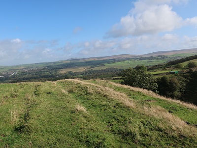
The next half mile of the route gives you a taste of almost wild country

as you follow the clough up towards Crown Point Road.

The path is always clear but can be very boggy after prolonged spells of wet weather. Be on the lookout for deer - they are frequently spotted in this area.

After stiles, duckboards and footbridges the path levels out with superlative views behind.

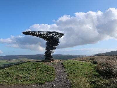
As you near the road be alert for a path on the left indicated by a shin height signpost. This takes you on a parallel course to the road but keeps you off it and brings you to Crown Point car park. The Singing Ringing Tree is reached by an enclosed path leading down from the rear of the car park.

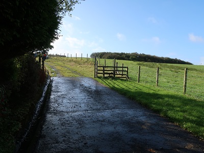
to an awkward stile by a stone wall and gateway.

Now with a wall to your left keep heading downhill to reach a gate

leading onto the drive close to the garage of a property. Follow the drive down to the A671 Bacup Road. Cross the road and turn right. Soon after turn left onto a footpath

that drops away steeply from the road. Keeping to the right of the field continue downhill to a stile leading onto a junction of tracks close a cluster of farm buildings.

Cross the junction to pass through the yard of Dyneley Farm. As you enter fields on the far side keep left and left again to take a path through a metal gate and then bear right towards a brow with "the Fireman's Helmet" wooded knoll to its right.

(Note helmet effect of this feature somewhat spoilt by the radio mast protruding from the trees.) Through a gateway the path heads downhill
to pass under the railway line

and then continue to the A646 close to Walk Mill. Turn right and then left

into Park Road. Follow until it brings you to a gate leading into a vast expanse of open space heralding Towneley Park.