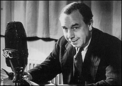
These “Postscript” programmes were almost as popular as Churchill’s speeches and attracted huge audiences. As much as commenting on aspects of the war itself Priestley looked ahead to what would happen afterwards. He recognised that things would have to change. In pointing out the inequalities of British society of the time one end characterised by “pleasant, able-bodied persons who, because of some system of private incomes or pensions and all kinds of snobbish nonsense, are condemned to yawn away their lives, forever wondering what to do between meals” Priestley looked forward to a fairer society in which “each [person] gives according to his ability and receives according to his need”. Such views paraphrasing Karl Marx led to the BBC cancelling the talks in the autumn of 1940. But the seeds had been sown. In the election after VE day in 1945 a Labour government was elected with a radical agenda including the creation of a National Health Service which was established in 1948. The present coronavirus emergency has made us wake up to just how much the nation relies on this sector of the welfare state. When it is over it may make us re-order our values – perhaps rewarding doctors, nurses and hospital cleaners (indeed all cleaners) a great deal more (and bankers, CEOs and premiership footballers a great deal less.)

Fact file

Directions: On the north side of the car park go through a wooden gate

and then turn almost immediately right climbing uphill to a wooden gate between a fence and a wall. Through this continue to a small utility building and then turn left. Now in the steep sided valley of Buckden Gill

the idea is to follow it up to the old workings of Buckden Lead Mine. Stay alert for the path is not always easy to follow as it negotiates a number of waterfalls on the ascent .

At the lower level it sticks to the left of the stream as it tracks towards the first cascade. As you close in on this the route switches back climbing a short rocky scramble
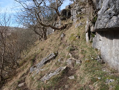
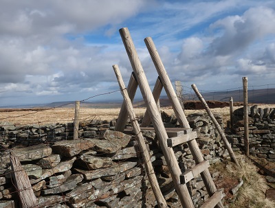
onto the next limestone shelf on a level with the waterfall. Cross a stile and then go through a gate
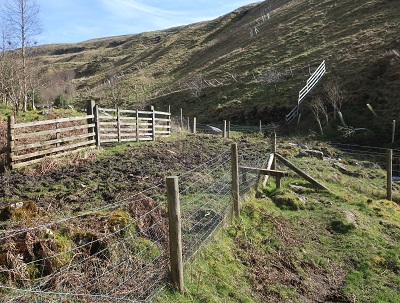
towards
the next waterfall.

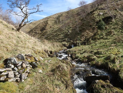
When a definite path develops on the right of the beck find a safe place to cross and join it. Negotiating the next two falls necessitates climbing up grassy slopes bearing right away from the stream.

By this stage you ought to be exhilarated especially by the views back down the gill to Wharfedale. As you near the remains of the Buckden Lead Mine re-cross the stream and aim to the left of an old spoil heap.

Now the walking becomes a little more pedestrian!

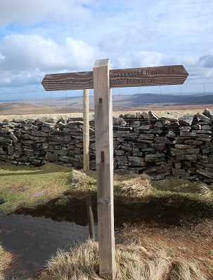
leads across moorland towards the summit ridge of Buckden Pike. After joining a wall on the left keep left when the path divides and keep climbing to the ridge reached at a wall corner and a ladder stile.
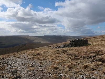
Across the stile a short stride of 100yds will take you to the trig point and nearby summit cairn which presumably is the "pike".

On a clear day this is a place to savour. In all directions the high fells stretch away giving the impression of emptiness. On our crowded isle how can such seemingly remote places exist "far from the madding crowd" - but they do and when you next get the chance do not hesitate to seek them out.
Return to the ladder stile and continue along the ridge for ½ mile

to where another ladder stile crosses a wall corner. Here there is a sad memorial dedicated to the Polish crew of a Wellington bomber that crashed here in 1942.

There is quite a story to this accident which can be read on http://www.buckdenpike.co.uk/mainstory.html . From the cross a wide, worn and sometimes very boggy path leads downhill

with the wall on the right. In a 1/4 mile just before the next corner turn right through a gate on what is a bridleway. Follow this down


to Starbotton - easy stated than done since Starbotton is over two miles away a good hour's walk. At Starbotton on reaching the main road close to the Fox and Hounds pub go left.
Just outside the village turn right onto a path that leads down to the River Wharfe. After crossing the footbridge

turn right to follow the Dales Way

upstream for another 2 miles

to arrive at the road bridge between Buckden and Hubberholme.
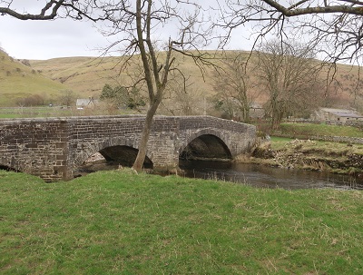
Cross it for the village.